5 Stunning Sunset Hikes in Alabama

Sunset on Ruffner Mountain

Ruffner Mountain hosts some of the best sunsets in and around Birmingham. Photo by Rain0975.

Alabama is blessed with more than a few spots in the great outdoors with vistas that are perfect for watching a sunset. From an easy walk on the Gulf Coast to a challenging trek in North Alabama, we have five favorite sunset hikes around the state.

A quick heads-up before you head out: Take caution when hiking during the sunset hours. Prepare for low-light conditions with flashlights, headlamps, and other essentials like a compass. The hikes listed here are all well-maintained and popular, yet hikers should always arrive prepared and navigate cautiously when visiting after dark.

1. Ruffner sunset hikes

Ruffner Mountain at Sunset

Ruffner Mountain Nature Preserve is popular with Birmingham residents for many reasons. It’s accessible enough for a quick after-work hike; its 14 miles of interconnected trails give hikers and trail runners plenty of recreational opportunities, and the mountain’s abandoned mines recall an era of forgotten history.

The sunsets, though, are among the best around Birmingham. Ruffner Mountain offers numerous west-facing viewpoints for watching the sunset beyond the downtown skyline; a recommended favorite is the quick (yet moderately challenging) Overlook Trail. At less than a half-mile, the trail ends at a viewpoint above a quarry, where hikers can enjoy panoramic views of the sunset. The trail’s popularity and distance make it a safe bet for quickly returning to the car—even after dark.

2. Dauphin Island sunset stroll


Dauphin Island offers several beaches and viewpoints for watching the sunset. 

It’s almost impossible to talk about Alabama’s best sunset hikes without mentioning Dauphin Island, which bills itself as the “Sunset Capital of Alabama.”

Three miles south of Mobile Bay, Dauphin Island is the southernmost point in Alabama. The 14-mile-long island (population: 1,300) has become a popular, albeit low-key, tourist destination in recent years, thanks in part to its white, sandy beaches and numerous walking trails.

Hikers won’t have to go far—or work hard—for a breathtaking sunset. The island offers miles of mostly flat walking and cycling trails, with unobstructed viewpoints aplenty in East End Park, Magnolia Park, West End Beach, and Dauphin Island Public Beach.

3. Vulcan Trail at sunset

The mostly forested Vulcan Trail offers numerous clearings and viewpoints for enjoying the sunset. Photo by Lee Adlaf

The paved Vulcan Trail contains all the ingredients for an idyllic sunset hike. It gains less than 200 feet, so hikers won’t be too out of breath to enjoy the views; the path follows the ridge of Red Mountain, giving visitors a glimpse of the region’s natural beauty; and the short length (a mile each way) means that it’s a relatively easy jaunt to return to the trailhead after dark.

Trees line the vast majority of the Vulcan Trail, but the occasional viewpoint promises wide-open views of downtown Birmingham, nearby mountain ridges, and more. If you have time beforehand, head to nearby Vulcan Park to learn about the region’s rich mining history and enjoy other panoramic vistas.

4. McDill Point sunset trek

Ambitious hikers, this one’s for you: McDill Point offers an overnight trek near Cheaha State Park, so you can extend that sunset hike into a longer adventure. Hikers making the effort will be rewarded with gorgeous sunsets behind the tree line, not to mention starry night skies above.

Hikers start the 3.2-mile hike on the Pinhoti Trail, pass through the Cheaha Wilderness in the Talladega National Forest, take the McDill Point spur trail, and eventually arrive at their destination: a series of boulder cliffs at McDill Point. (Note: This area is protected from the wind and is an ideal spot to set up camp.)

A quick scramble up the boulders takes hikers to a west-facing outcrop with views of the surrounding forest and the wide-open night sky as the sun dips—quite a memorable way to end the day.

5. Gulf State Park sunset walk

Gulf State Park hosts two miles of sandy beaches for relaxing and watching the sunset. 

The Gulf Coast hosts dozens of viewpoints, parks, and trails for enjoying the sunset, but one that’s especially awesome is Gulf State Park. The picturesque park hosts two miles of white, sandy beaches and a fishing pier that extends more than 1,500 feet into the Gulf—both of which offer plenty of room and unfettered views as the sun descends behind the horizon.

Hikers and cyclists looking for added adventure can hit up the park’s 15-mile Hugh S. Branyon Backcountry Trail system. Gulf State Park’s seven, well-graded paths take hikers through a lush maritime forest, windswept sand dunes, and inland lakes. Along the way, hikers might spot a bobcat, white-tailed deer, or sunbathing alligator.

Written by Matt Wastradowski for RootsRated in partnership with BCBS of AL.

Need to upgrade your summer adventure gear? We can help! Alabama Outdoors wants everyone to enjoy the outdoors, and we work to build loyalty one connection at a time. Visit one of our stores or take advantage of our shipping or convenient in-store pickup! #BeOutdoors


How to Get Started with Trail Running in Alabama

Two men trail run in Alabama.

Throughout Alabama you’ll find beginner and advanced trails. Rock/Creek

With 21 state parks that occupy a wide variety of terrain, Alabama is the perfect place to take up trail running. Whether you’re looking for a gentle jog through serene woods or a challenging trek up a rocky mountainside, you’ll find nearby trails to suit your desires.

Throughout the state you’ll find beginner and advanced trails, giving you the freedom to test your level of skill and endurance as you gain experience and progress. However, trail running is not without its own intricacies, so we’ve shared expert advice to ensure that your first foray into the sport is successful.

Join A Group

When you’re taking up a new sport or activity, it’s smart to learn from experienced veterans who know the ins and outs. If you run with a group, it will not only help ease your doubts, but you’ll avoid rookie mistakes and progress faster. Groups like the Birmingham Ultra Trail Society (BUTS), We Run Huntsville, or the Auburn-Opelika Running & Track Association will help make trail runs more enjoyable and keep you motivated to stay with the sport.

Gear Up

5sdbmq5kzYWu06k6gEWYmyMake sure you’re properly equipped to handle the rigors of the trail. Rock/Creek

Like all sports, trail running has gear specially designed to meet its demands. While you don’t have to go crazy with new gear, it is important to invest in good trail-running shoes that will provide adequate support, traction and protection on rugged terrain. You’ll thank yourself for investing in a nice, comfortable pair of trail runners as you confidently grip red clay, leap over protruding roots, and gallop surefooted downhill on the tail end of a run.

For the most part, running short distances on trails is a minimalist sport. However, like all runs of significant length, you need to ensure you are properly equipped to handle the rigors of the trail. To stay as dry and comfortable as possible, you should wear technical clothing that helps you manage moisture, wind and your body temperature. Also, you should carry water to stay hydrated and pack gels or other foods to maintain your energy. If there’s any possibility that you might get lost, you should also take navigation tools.

When you’re ready to shop, you can buy shoes, clothing, accessories and other gear at a specialty running store, like Fleet Feet Sports, or an outdoor specialty store, such as Alabama Outdoors or Mountain High Outfitters.

Jumping from the Road to the Trail

Time to talk technique. As you transition to the trail, you’ll have to slightly modify how you run. Strides need to be shorter, especially on an incline. This will allow you to react quickly to obstacles that will pop up on your run. Make sure you pick your feet up, maintain good balance, and keep your eyes down while scanning the terrain 15 feet or so in front of you. If it looks like two steps are needed, go ahead and take three. Being alert and aware is key.

Be Safe, Not Sorry

Part of participating in any sport is being safe and avoiding injury. With trail running, you must take a few extra steps on top of the standard rules for running.

Wear brightly colored clothes. If something does happen, you want a park ranger or someone else to locate you easily. This also helps identify you as something other than food for the freezer during hunting season. Second, get a map of the trail system and have a navigation aid. Make note of the phone number for the park ranger, and save it in your phone. It’s easy to get turned the wrong way while on the trail, even a well-marked one. Next, know what the hazards are. Alabama is home to more than 50 species of snakes, six of which are venomous, some of which you will see on the trail.

Also, if you couldn’t meet up with your group or a friend to run, make sure you tell someone where you are running and when you should be back.

Know the Rules of the Trail

Yo7uSyMwmaQ6MwQQgEec4You’ll find great running trails at award-winning Oak Mountain State Park outside Birmingham. Rain0975

Every sport has its own etiquette, designed so everyone has opportunity to enjoy it equally. Trail running is no exception, and its rules aren’t much different from those you follow when hiking or camping. Take out what you brought in, stay on the trail, and be kind.

However, it’s important to know who yields to whom when a trail runner encounters a hiker or mountain biker. If you didn’t know, yield to those on the uphill—they have a limited field of vision. Everyone yields to horses, and mountain bikers yield to everyone else. However, don’t assume anything, just be alert and use good judgement. Don’t sneak up on a hiker or fellow runner. If you offer a simple, “On your left,” you’ll keep them from jumping out of their shoes. Also, if a mountain bike is coming at you on a narrow trail, be kind and step off for a second to let the rider pass. They’ll appreciate it.

Where to Trail Run in Alabama

Now you need to know where to go. In Alabama there’s no shortage of trails, and the Alabama State Park system features some of the most diverse trail systems in the country. You’ll find great running trails at award-winning Oak Mountain State Park outside Birmingham; Monte Sano State Park in Huntsville; and Cheaha State Park east of Birmingham. You can start checking out the list of trails for the Southeastern Trail Run races or the XTERRA Trail Run Series in Alabama. This will give you a good start toward finding a nearby trail or ideas for exploring a different part of the state.

Written by Hap Pruitt for RootsRated in partnership with BCBS of AL.

The Ultimate Alabama Road Trip: 7 Days of Adventure Across the Yellow Hammer State

The open road on a sunny day

            Alabama is home to 33 miles of the Natchez Trace Parkway. Carol M. Highsmith


If you’re from Alabama, and you’ve been on a plane, at some point you’ve explained to the stranger beside you that your home state is not one huge cotton field. Indeed, there’s a common misperception that Alabama is a monolithic, rural environment from one end to the other.

In fact, Alabama is one of the most biologically diverse states in the country, with at least 64 ecosystems, including forests, wetlands, prairies, rivers, streams, and marine ecosystems in its 52,419 square miles. All that diversity—and the adventure that goes with it—is ready to be explored during an easy-to-tackle road trip.

Indeed, if you’re still thinking about options for summer vacation, the 760-mile road trip we’ve outlined below will offer plenty of exploration. Along the way, you’ll encounter lush wilderness areas, mountains, canyons, and white sand beaches where you can hike, bike, climb, kayak, swim, or just relax after a few hours in the car.

As you travel Alabama’s highways and byways, you’ll also follow the course of its rich cultural history. While some roads trace ancient paths used by Native Americans, others follow the footsteps of Civil Rights marchers.

To help you get the most out of an Alabama road trip, here’s a 7-day itinerary that takes you off the beaten path to pursue a wide range of adventures.

Day 1

Natchez Trace Parkway to the Bankhead National Forest ** 87 miles, approx. 1.5 hours**

Begin your journey at the Alabama/Tennessee border and travel south on the Natchez Trace Parkway, winding through quiet woodlands and pastures with nature paths and historic sites dotting the way.

For more than 10,000 years, people have traveled this route, which is now a National Scenic Byway that stretches 444 miles from Mississippi to Tennessee. It was not only a footpath for Native Americans, but also a trade route for settlers in the 18th and 19th centuries.

From the Natchez Trace Parkway milepost 341, continue southwest for about 11 miles to reach Rock Spring, where a nature trail will lead you to the deep pools of a small natural spring.

Continuing on the Natchez Trace Parkway, you’ll cross the Tennessee River and at milepost 320 arrive at Buzzard Roost Spring. In the 1800s, the site was known as Buzzard Sleep, because the Chickasaw chief Levi Colbert ran an inn for travelers. Here, you can take a short walk to the spring that served as a water source for Colbert’s inn.

After visiting Buzzard Roost, take Alabama Highway (AL) 72 East for about 50 miles to Moulton. Then take AL 24 to AL 33 and travel south to reach the Bankhead National Forest.

Covering more than 180,000 acres, the Bankhead is known as the “land of a thousand waterfalls,” and it includes the Sipsey Wilderness, which resembles the north Georgia mountains with wild streams, limestone bluffs, hemlock trees, and mountain laurel.

After you travel approximately 14 miles on AL 33, you can take a quick detour to access the Borden Creek trailhead for a day hike or overnight trip in the Sipsey Wilderness. Turn right onto Winston County Road 60, go 0.6 miles and turn right onto FS224 at the Borden Creek Trailhead sign. If you continue 2.2 miles, you’ll reach the trailhead parking area.

Day 2

Lookout Mountain Parkway to the Appalachian Highlands **165 miles, approx. 3.5 hours**


Little River Falls in Little River Canyon is one of Alabama’s most scenic waterfalls..                                Little River Falls in Little River Canyon is one of Alabama’s most scenic waterfalls. Jody Claborn


On Day 2 you’ll cross Alabama to ride along the spine of its eastern mountains.

From the trailhead parking lot in the Sipsey Wilderness, return to AL 33 and travel south about 13 miles to Double Springs. Then, go east on AL 278 90 miles to Noccalula Falls Park in Gadsden.

During the drive to Gadsden, stop in downtown Cullman for lunch at the Red Door Emporium Café, which occupies a house dating back to the 1800s. Order a tasty biscuit or chicken-salad sandwich, and for a cool souvenir of your trip, check out the paintings, pottery, and other artwork made by Alabama artists.

At Noccalula Falls, take in the view of the park’s 90-foot waterfall, which is one of the most frequently visited natural landmarks in the state. From the park, take Tabor Road and travel northeast to begin your journey on a portion of the Lookout Mountain Parkway, which passes waterfalls, canyons, scenic views and small towns, from Gadsden to Chattanooga.

Follow Tabor Road, which becomes AL 176 and County Road. 89. In Fort Payne, turn right on AL 35, and then travel about 8 miles to Little River Canyon National Preserve.

Boasting some of the most rugged terrain in the state, Little River Canyon offers sandstone cliffs for rappelling and climbing, as well as wild streams for fishing, swimming, and paddling. If you hike the trail to Little River Falls and continue downstream, you’ll reach Martha’s Falls, where rock outcrops surround a deep swimming hole.

If you’d rather press on, take AL 35 to Alabama Highway 176 and turn right to begin a scenic drive along the rim of the canyon. Up for roughing it for the night? Drive to Little River Canyon’s Slant Rock backcountry site, which is right on the river. (There are no amenities.) For something a bit cushier, head to the campground at nearby DeSoto State Park.

Day 3

Little River Canyon to Cheaha State Park ** 80 miles, approx. 1.5 hours**

Cheaha Mountain is the perfect lookout at Cheaha State Park.                                                           Cheaha Mountain is the perfect lookout at Cheaha State Park. Alan Cressler


After you’ve explored Little River Canyon, backtrack to AL 35 and travel southeast to follow the Appalachian Highlands Scenic Byway to wind through a pastoral landscape with cotton fields and pastures tucked away in mountain valleys.

In the town of Blanche, turn onto AL 273 and travel south approximately 16 miles to Leesburg. Travel south about 1 mile on AL 68 and turn left onto US 411/AL 68. Go 5.6 miles and turn right onto Piedmont Rd/AL 9. From here, your next stop is Cheaha Mountain, the highest point in Alabama.

For a more adventurous, off-the-beaten-path route to Cheaha, proceed to U.S. Highway 78 and, just west of Heflin, turn right onto AL 281 to travel south and follow the crest of the Talladega Mountains. You’ll go another 20 miles to reach

Cheaha State Park.

Sitting at 2,407 feet above sea level, the park offers awesome 360-degree views of the surrounding Talladega National Forest.

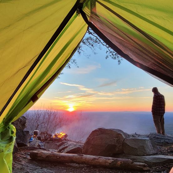
The park also provides access to miles of hiking trails that traverse immense forested areas. From the park’s Cheaha Trailhead you can reach the Pinhoti Trail, a 335-mile path that passes through Alabama and north Georgia to connect to the Appalachian Trail. Another option is to begin at the Cheaha Trailhead and hike three-plus miles to McDill Point, a west-facing outcrop where you can relax in a hammock and enjoy sunset.

Cheaha State Park is also the jumping off point for the Odum Scout Hiking Trail, which stretches 7.5 miles along the eastern slopes of Talladega Mountain in the Cheaha Wilderness Area. For experienced mountain bikers, the park has about six miles of trails with fairly rocky terrain, a few short but steep climbs, and fast sections of singletrack.

After a day of adventure, you can choose from a wide range of park accommodations, including primitive and improved campgrounds as well as cabins.

Day 4

Cheaha Mountain to the Black Belt Nature and Heritage Trail** 177 miles, approx. 3 hours**

The Edmund Pettus Bridge's unique design makes this structure a spectacular sight.                                   The Edmund Pettus Bridge’s unique design makes this structure a spectacular sight. Tony Webster


After your deep dive into the mountains, emerge on day four to tour several historical sites in the Black Belt region of the state. Known for its rich soil, the Black Belt was home to cotton plantations in the 19th Century. After the Civil War, this part of the state was a focal point for the Civil Rights movement. Over the years, the Black Belt has also become known for its soul food and thriving folk art.

From Cheaha State Park travel southeast on AL 281 for 3.3 miles, and then turn right onto AL 49. Travel south on AL 49 for 80 miles and then follow County Highway 36 and AL 126 another 7.3 miles to Tuskegee.

In Tuskegee you’ll find several excellent African-American history museums, including the George Washington Carver Museum and the Tuskegee Airmen Museum, which chronicles the heroic efforts of African Americans who flew and fought in World War II.

Because Tuskegee is a college town, you’ll find plenty of places for a snack, but don’t get too full. From Tuskegee, you’re going to make your way to I-85 and travel west for just 40 minutes to reach downtown Montgomery and the Railyard Brewing Company. Choose from a wide range of beers on tap, including the Barrel Aged Big O Stout, the Deadhead American Pale Ale, and special small batches brewed on Fridays. The Railyard also serves a wide range of food, including burgers, fish tacos, and even etoufee.

From the pub, you only have to go a few blocks to reach the State Capitol Building and the Museum of Alabama, which is located at the Alabama Department of Archives and History. The museum is a must-see, with hundreds of artifacts, images, documents, and audiovisual programs that tell the story of the Civil War, industrialization in the state, world wars, civil rights, and the Space Program.

Continuing your trip through time, leave the Capitol and take I-85 South a little over a mile to U.S. 80 West. Travel about 50 miles on U.S. 80 West and you’ll cross the Alabama River on the Edmund Pettus Bridge.

On March 7, 1965, this steel bridge became one of the iconic landmarks of the civil rights movement, when law enforcement officials used billy clubs and tear gas to attacks civil rights marchers. Television coverage of the violence rallied the country to support the marches, and less than five months later President Lyndon Johnson signed the Voting Rights Act of 1965.

Day 5

Selma to Gee’s Bend and the Gulf Coast **195 miles, approx. 4 hours**

A member of the famous Gee’s Bend quilting group.                                                                      A member of the famous Gee’s Bend quilting group. Andre Natta


On Day 5 you’ll leave Selma and move off the beaten path to visit Gee’s Bend, one of the state’s most remarkable destinations.

Situated along the Alabama River, the small hamlet of Gee’s Bend is home to a community of famous quilters whose work has been displayed in art museums throughout the country. Historians consider these quilts some of the country’s most important pieces of African-American art.

From Selma, travel south on Al 41 for about 35 miles to Camden. Then, follow AL 28 north to Ellis Landing Road. Turn right and drive approximately three-quarters of a mile to a ferry landing. The ferry will take your vehicle across the Gee’s Bend, where you can visit the Quilting Collective, which has displays on the history of the quilts, plus a large collection of quilts and artwork available for purchase. Also, quilters usually gather at the Boykin Nutrition Center to quilt from 8:30 am to 1:30 pm, Monday through Thursday.

After visiting Gee’s Bend you’ll begin a three-hour drive to Orange Beach on the Alabama Gulf Coast, where you can relax on the beach and enjoy the sunset.

From Camden, take AL 265 and AL 21 south to I 65. Take I 65 South 19 miles and exit to take AL 287 for 23 miles and then take I 10 East. Go 5 miles and take exit 49 to travel south on the Baldwin Beach Expressway for about 25 miles. (There is a toll to cross a bridge near the end of the Expressway). Turn left to travel east on AL 180 to reach Orange Beach.

Because the Gulf Coast has become such a popular destination, you’ll need to book your accommodations in Orange Beach as far in advance as possible. After arriving at your rental house or condo, head out to the Palms Bar & Grille for a waterfront table and seafood feast.

Day 6

Orange Beach and Gulf Shores **6 to 7 miles, approx. 12 minutes**

Make sure to stick around for the incredible sunsets on the Alabama Gulf Coast.                                         
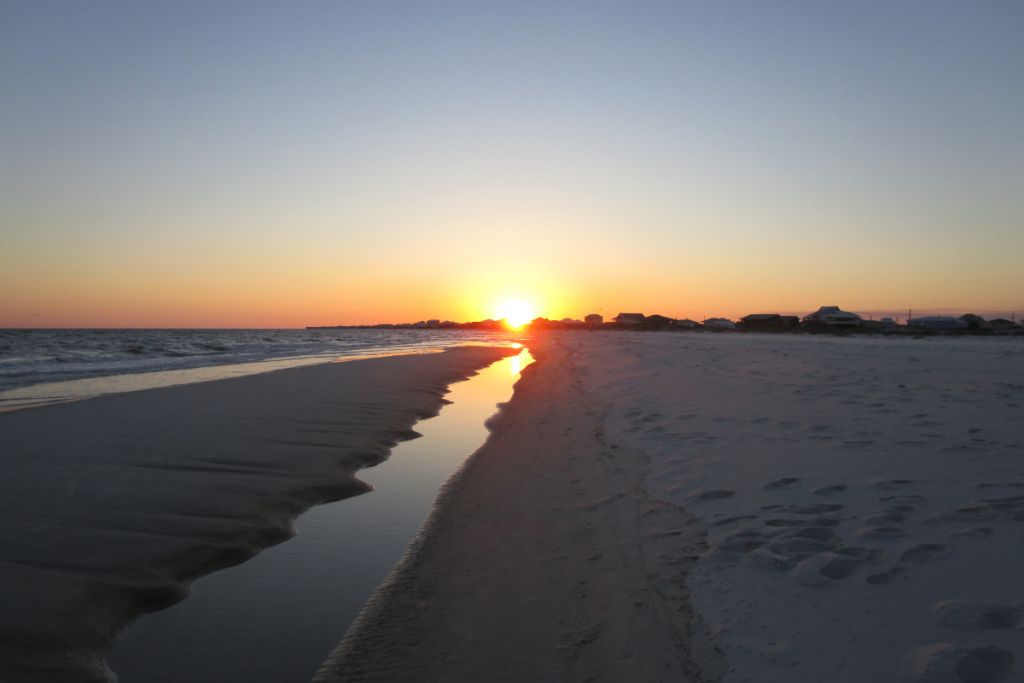
Make sure to stick around for the incredible sunsets on the Alabama Gulf Coast. Suzanham


Take a break from the long drives for a day of enjoying the sand, surf, and the outdoor adventure on the Gulf Coast.

You might want to just grab a book and a beach chair and spend the day soaking up rays. Chances are, your house or condo will have access to great beaches, but you can also head west about seven miles to access beaches at the Gulf State Park Pavilion, 2nd Street Public Beach, and the Gulf Shores Public Beach at the end of Alabama Highway 59.

But for a more active-minded itinerary, deep-sea fishing is an excellent option, especially for anglers: Orange Beach boasts the largest offshore charter fishing fleet along the Gulf Coast. Whether you want to go out for a few hours or a full day, you’ll have no problem finding a charter that suits your needs.

While the ocean takes center stage for recreation, the Gulf also has plenty of inland lakes perfect for kayaking and stand-up paddleboarding. Head over to Lake Shelby at Gulf State Park to paddle calm waters and watch for osprey and eagles soaring overhead. At Alabama Paddlesports, rent kayaks and stand-up paddleboards or even book a guided kayak tour.

For dinner, try the famous banana-leaf-wrapped fish or sushi at Cosmo’s Restaurant and Bar, or get another waterfront seat at one of the three Tacky Jacks restaurants in the area.

Day 7

Orange Beach to Dauphin Island and Bayou La Batre **53 miles, approx. 2 hours**

The birds at Dauphin Island, like this egret, are captivating.                                                               The birds at Dauphin Island, like this egret, are captivating. Stephanie Pluscht


On Day 7 your Gulf Coast adventure continues with a drive west to Dauphin Island, a barrier island that’s home to a research lab, aquarium, and an Audubon Bird Sanctuary.

From Orange Beach, travel west on AL 180 for about 30 miles to reach the Dauphin Island-Fort Morgan Ferry. Take the ferry to Dauphin Island, and then proceed to the Estuarium that includes a 7,000-gallon stingray touch pool and the Living Marsh Boardwalk.

In the afternoon, drive west 20 miles to Bayou La Batre, the small town made famous by the book and film Forrest Gump. Considered the seafood capital of Alabama, Bayou La Batre has a clutch of harbors and shipyards that employ master ship builders and shrimpers, including a significant population of Vietnamese. If you explore the village, you might even encounter a Vietnamese grocery store.

Ironically, there aren’t many seafood restaurants in Bayou La Batre, but make the trip to The Lighthouse Restaurant in nearby Irvington to sample the shrimp and crab claws. If you’ve booked your Orange Beach accommodations for several days, you can head back, as Bayou La Batre marks the end of your 760-mile journey across Alabama.


Written by Marcus Woolf for RootsRated in partnership with BCBS of AL.
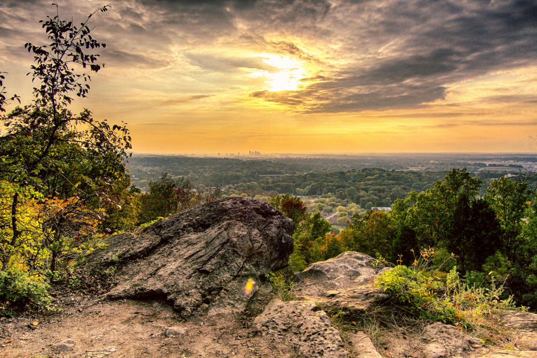
How to Clean Your Chaco Sandals

It's common knowledge that people who love their Chacos _really _love their Chacos. They'll wear them anywhere while doing just about anything—from rock hopping, to running errands, to participating in life events as traditionally 'non-Chaco' as they come (like getting married, for instance). The original Chaco sandals were designed for river guides, and to this day they still perform exceptionally well in water. But true “Chaconians” love to wear them across all disciplines (hiking, backpacking, rock climbing, kayaking, to name a few) and in all seasons.

Yes, Chaco now makes closed-toe shoes and hiking boots constructed of high-quality leather and suede that offer additional protection for adventures you’re not willing to risk losing a toe for… but let’s talk about the sandals.

See, Chaco sandals have earned a reputation for exceptional durability, and it’s not uncommon that a pair can go 10 years without the footbeds or straps needing to be replaced. But as any Chaco fan can tell you, all that relentless use over a long period of time can leave them with a pretty distinct and funky smell. Don’t act surprised—we know you know what we’re talking about, and we’re trying to keep your friends from having to host an intervention.

Here are some insider tips for cleaning your Chacos. Your feet will be happier for it, and your tent-mates will be happier too.


Jake Wheeler

Don't be afraid to throw them in the laundry (but not the dishwasher).

Chaco recommends occasionally throwing your sandals—provided they’re not the leather kind—in with a load of laundry for a gentle cycle in cold water with a mild detergent (read: nothing that contains chemicals that might eat at the straps). Do not bleach! After letting them air dry, they’ll be good to go on your next outdoor adventure.

Between washings, you can try wearing them in the shower now and then to keep skin cells from building up in the grooves of the footbed. Yeah, ew. This sounds like the lazy-man’s version of actually washing them, but it works surprisingly well.

Whatever you do, do not put your Chaco sandals in the dishwasher or in the dryer, as the heat can cause the adhesive in the outsoles to break down. You can’t un-melt glue, and your sandals won’t be as fun to wear if the soles fall off (or halfway off), so heed our warning on this one. Just let them sit in a nice, sunny spot for a while and they’ll dry off pretty fast.

"Floss" the straps.

Flossing isn't just for teeth: This handy technique can also remove dirt that gets stuck where the shoe's webbing and straps thread through the midsole, which can trap odor and cause the adjustable straps to stick. If that happens, the company suggests “flossing” the straps—squirting fabric softener into the strap slots and pulling the straps in and out to remove the offending grit. This is actually one of the primary reasons for smelly Chacos, and why some sandals still retain an unpleasant aroma even after washing.

If you’ve never done it, or if the sandals are old, it can be pretty tough to move the straps, but just be patient and make sure the straps are thoroughly wet first. The Z-series sandals feature one (or more) continuous straps that pass through the sole multiple times, which is what allowed you to adjust the fit of the straps to your feet when you first bought your sandals. All you’re doing here is moving the straps in and out of the sole so you can clean whatever is building up down there.

Flossing the sandals also keeps sand and grit trapped in the footbed from slowly sawing their way through your straps. Some people do this every time they wash a pair of Chacos, but if you keep them generally clean we’ve found that you’ll only need to do it periodically.

Make an easy at-home solution for cleaning.


Jonathan Morua

If your Chacos do come to elicit a persistent smell (because they’re comfortable enough to wear for 12-hour-stretches, which you do), don't fret. Instead, scrub the footbed with a firm brush and a mix of water and baking soda. Many Chacos are sold with an antimicrobial-treated footbeds, but there are special sandal washes that can be applied after purchase as necessary.

Treat the leather extra-special.

The leather in some Chaco models needs to be cleaned by hand. To get rid of any accumulated grime, use a damp cloth and a cleaning solution specially designed for leather goods.

That’s it! Like any other piece of essential outdoor gear, if you take care of your Chacos, they will take care of you as you hit the trail (or river or mountain) for countless miles full of adventure. That’s why you bought them in the first place, right?

This content was produced for your enjoyment, thanks to a partnership among OSM, Osprey Packs, Chaco, and RootsRated.

Originally written by RootsRated for Outdoor Sports Marketing.

Featured image provided by Cody Myers

How to Fit a Pack

Backpacks are one of those integral pieces of gear that can make or break an adventure. Whether you’re looking to spend a few hours on the trail or even a few months on an epic thru-hike, your pack needs to be comfortable. In order for it to be comfortable, it needs to fit right. That’s why taking the necessary time before your trip to ensure that you have the pack that is right for you is imperative. Otherwise your weekend backpacking trip might just turn into an experience you’ll remember for all the wrong reasons.

Whether you’re in the market for your first pack or just in need of a serious upgrade after 10 years, here are some things to think about next time you head towards the pack wall of your local Alabama Outdoors store.

Hen Wallow Falls is a fantastic 4.4-mile round-trip hike to a beautiful 90-foot waterfall in the Smokies.

Cody Myers

First things first, why do you need a pack? It’s important to identify what activities you’ll be using the pack for. Are you looking to hold water while training for your first half-marathon? Need something to carry your kiddos to help introduce them to the trails? Skiing? Climbing? Or are you looking to use this for some serious, long distance hiking?

Packs come in all shapes and sizes and range from less than 5-liter hydration systems to 105-liter heavy-duty mountaineering packs—so it really depends on how much you need to carry that will determine what size pack you should be searching for.

Choices for smaller packs (under 50 liters) are usually based more on the features you are looking for—lightweight material, pockets, hydration, etc. While features are still an important part of narrowing down your choice of a larger pack, larger packs also require more technical fitting to ensure comfort.

Summer, winter, rain, or shine, make getting outside a priority. Having the right gear can make all the difference!

Cody Myers

Once you’ve narrowed down your choices to less than a handful, it’s now time to try on pack after pack until you find the one that feels most comfortable. One thing to remember when doing so is that it’s important to try the pack on with weight in it. An empty pack feels very different on your hips, shoulders, and back than a full pack, and you need to have an idea as what it will feel like with all of your gear stuffed inside. Most gear shops will have weights or bean bags for you to add before you try it on.

Once your pack is loaded up, it’s time to get it on your back. When putting a new pack on for the first time, remember, there is a whole order as to how you should tighten the straps for a better fit (just another reason why having an expert show you the ropes, er, straps can be very helpful). After all, adjusting the straps out of order can completely change the way the pack sits on your hips, shoulders, and back.

First, you want to find the right spot on your hip to rest the hip belt. A good starting point is drawing a line from your belly button over to your hip bone. You’ll want to put the hip belt right over this part of your hip. Tighten for comfort. The majority of the pack weight should be carried by your hips. Next, tighten the shoulder straps. While you don’t want to carry much of the weight here, these help keep the pack close to your body. Then, adjust the load lifters (which help pull the weight off of your shoulders), and finally adjust the chest strap. There are a lot of different tips, tricks, and measurements that are used for each strap, so be sure you have a knowledgeable staff member there to help identify what these might be.

Having a well-fitted pack makes heading off trail, climbing, scrambling and jumping much less cumbersome.

Cody Myers

Once you are fully strapped in, take a walk. Walk around the store, bend up and down, do some squats and see how it feels. Take a few minutes with the pack and tweak the straps where necessary. If it doesn’t feel right in the store, it’s not going to feel right on the trail. Be honest with yourself, and try something else on if even the smallest thing feels wrong.

And remember, the staff at specialty outdoor stores is trained and most likely has a ton of personal experience on the trail, so they can normally help answer all of your questions about anything pack-related. So don’t feel intimidated, just head in and start trying packs on until you find the right one!

This content was produced for your enjoyment, thanks to a partnership among OSM, Osprey Packs, Chaco, and RootsRated.

Originally written by RootsRated for Outdoor Sports Marketing.

Featured image provided by Jonathan Morua